Wilmar Sugar's using GPS technology to help emergency services.
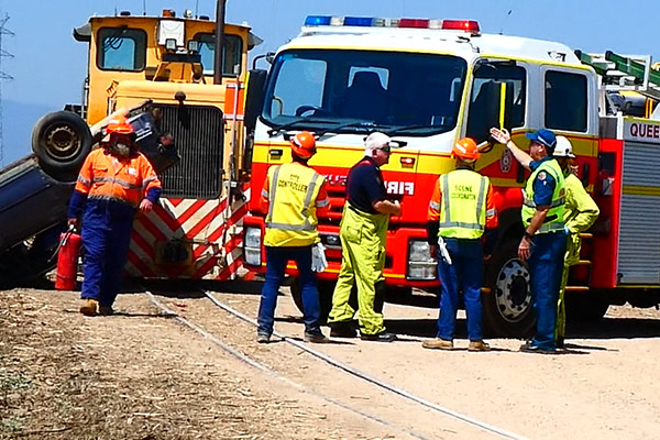
A recent mock railway incident in the Herbert region was the first opportunity to trial Wilmar’s new track layer over the Google Earth system.
Herbert Cane Supply Manager Jim Kirchner said the initiative was well received by first-responders.
“Having our railway tracks on Google Earth allowed us to share the exact GPS coordinates with police, fire and ambulance for where the training incident happened.
“Going forward, this information will be vital for those emergency service workers who might not be familiar with local roads,” he said.
Wilmar stages mock incidents across all of its milling regions each year to better prepare crews for emergency situations.
This year’s Herbert drill involved a car hitting a loco, causing the vehicle to overturn on the tracks.
Wilmar’s Cane Supply and Transport team worked with police, fire and ambulance for the training drill.
“It involved three casualties – two in the car and one in the loco,” Mr Kirchner said.
“Our crews were tasked with taking control of the scene until Queensland Fire and Rescue Service arrived, and then assisting emergency services with the response.
“Senior staff were very impressed with how everyone worked together, and how well our people understood the emergency response process.
“We were also able to see first-hand the benefits of the new incident location system,” he said.
Mr Kirchner said the training drill was also a reminder to the public to ‘use their train brains’ around level crossings.
“Despite there only being a few weeks left in the crushing season it’s important people don’t become complacent around railway crossings.
“Always give way to cane trains, obey all signs and signals, and stay clear of our locos, bins, tracks and points,” he said.
Wilmar owns and operates Queensland’s third largest rail network, with 1600km of track across its Herbert, Burdekin, Proserpine and Plane Creek milling regions.